One day · Wheatland & Foothills County, Alberta · 7 of 7 stops done · one collector, one phone
A one-day Ground Boots run out of Wheatland County: south on Hwy 817 to the Bow River at Carseland, west along Hwy 547
into Foothills County, a bike ride on the Okotoks river pathways, the 338 Ave crossing at Hwy 2, and home along Hwy 552 and the county gravel.
The phone sat on a dash mount the whole way, scoring road roughness and Rogers signal every few seconds. A widget on the home screen
counted what went past the windshield, and every photo went through a plant identifier. The plan changed on the road by voice, and this report
shows what was actually done.
Route changed by voiceFive planned stops dropped; new way home along Hwy 552.
12:49🏁
Trail ride endsBack at the truck.
12:55🦌
Deer48 Street E at 59 km/h (mapped limit 60)
12:58✅
7. 338 Ave E at the Hwy 2 crossingroad damage (none seen), general (none seen)
13:11🪧
Limit ≠ signHwy 552 at 72 km/h (mapped limit 100)
13:11📝
GeneralThere was a 65 speed limit at the top of this hill
13:55🏠
Home~162 km driven.
Findings
The roads were in good shape
975 roughness readings from the dash mount, and not one
rated rough. Paved roads had a median score of 7. The gravel home along 306 Ave E and Township Road 212 came in at
8, barely different. The bumpiest single reading was 26 on Hwy 817
at 09:15, still only "fair" (rough starts at 35). Dry and unfrozen, the gravel drove like pavement.
A sign the map doesn't know about
At 13:11 on Hwy 552 the widget logged
“limit ≠ sign”: the mapped limit is 100 km/h, and the note four seconds later says
“There was a 65 speed limit at the top of this hill”. That 65 sign isn't in the OpenStreetMap data, so the apps built on it (Ground Boots' own heads-up display included) show 100 there.
It's the kind of thing a road crew or a map editor can act on the same day.
The Bow, open and low
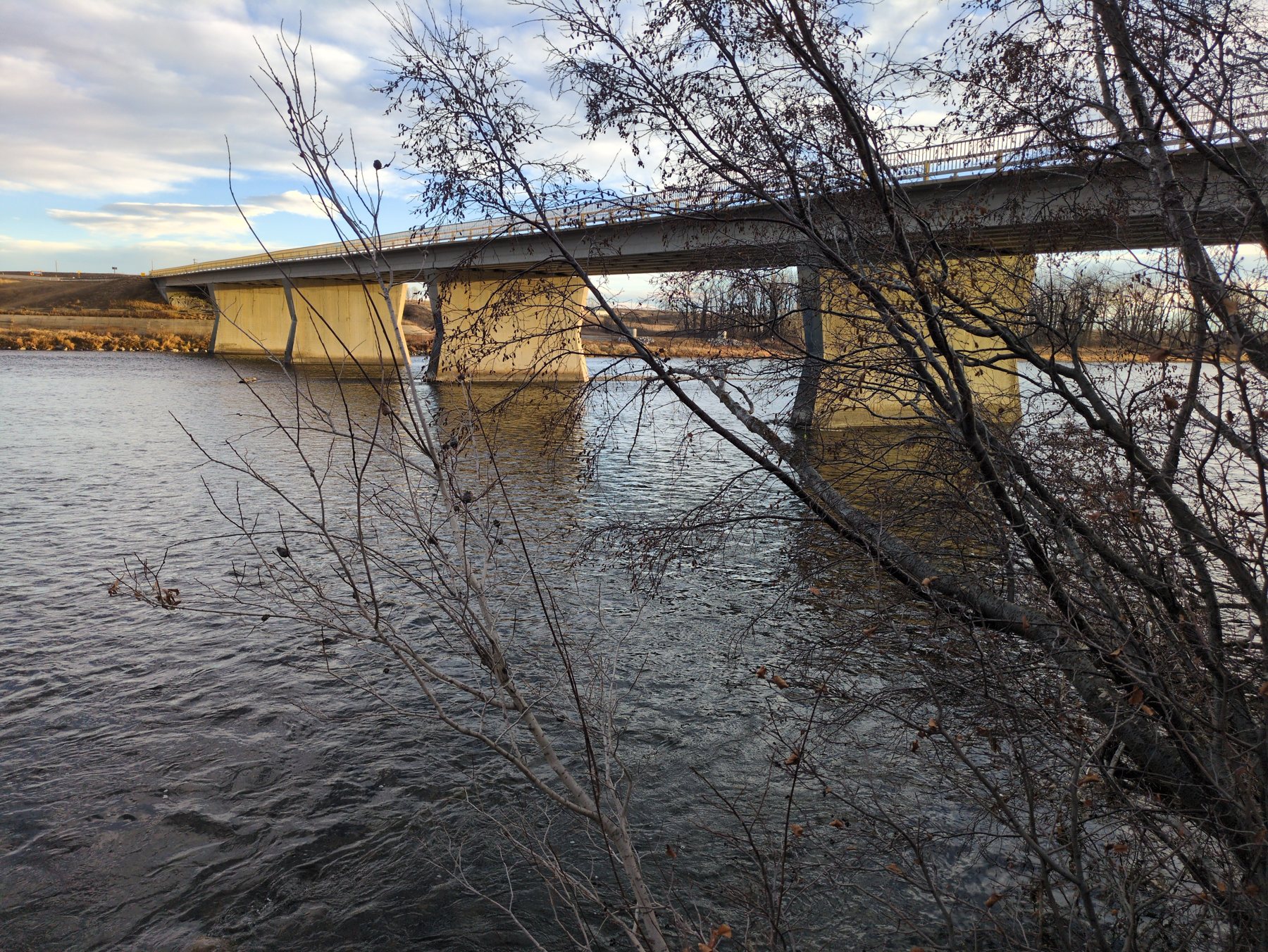
At Carseland the river ran slightly turbid with no ice and
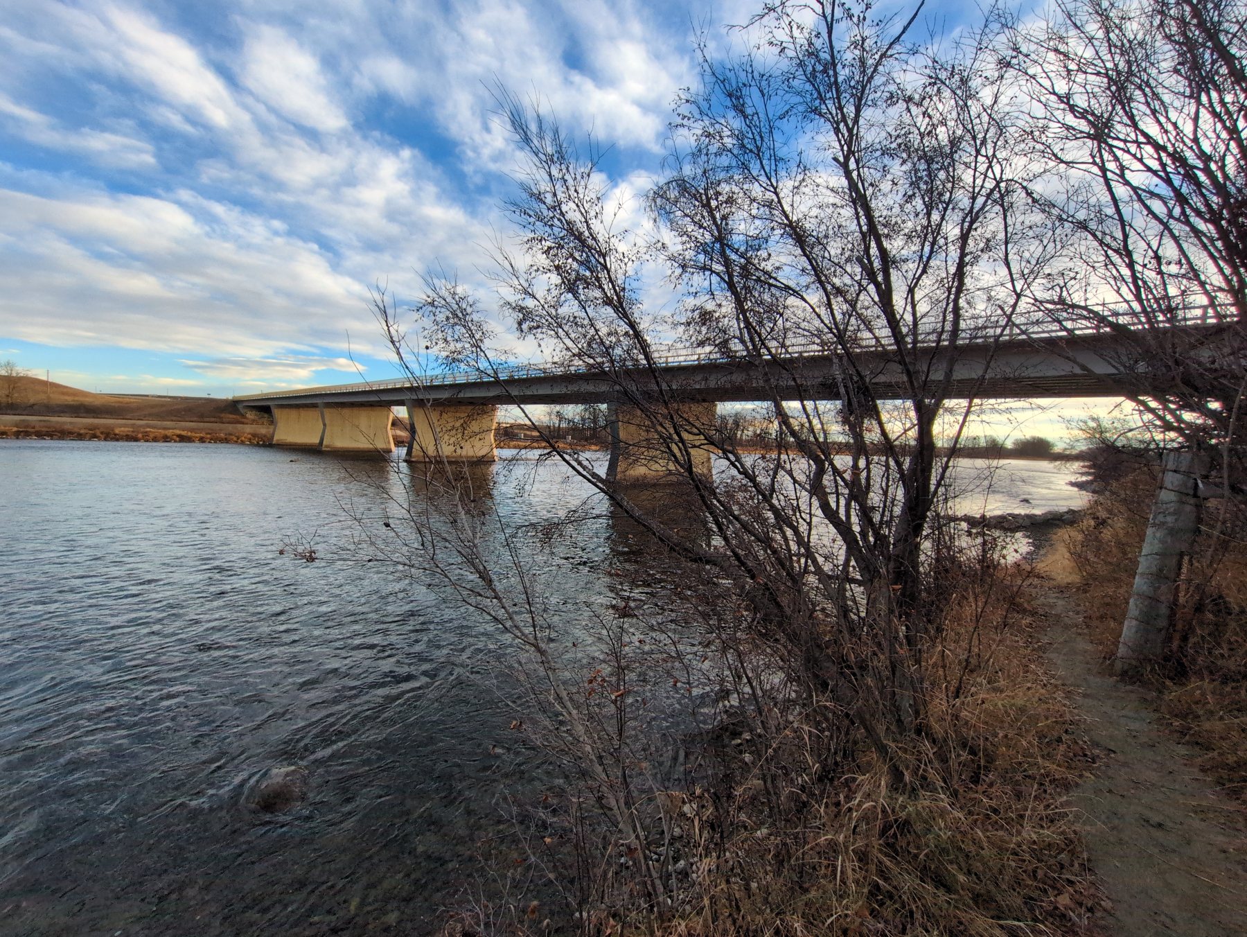
no waterfowl. The bank is willow and river alder under the Hwy 24 bridge, all bare by mid-November. The plant identifier picked out alder by the
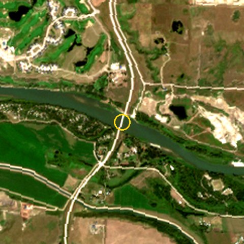
small woody cones still on the twigs, which willow doesn't keep. Five days after Trip 5 stood at the same bank, nothing had frozen yet. From orbit the Bow box held 34.3 ha of open water on 2026-08-15 and 24.2 ha on 2026-11-08, and the Sheep River by the trail 11 ha of open water on 2026-08-15 and 5.8 ha on 2026-11-08: the drop to low winter flow.
A first: a trail ride inside a trip
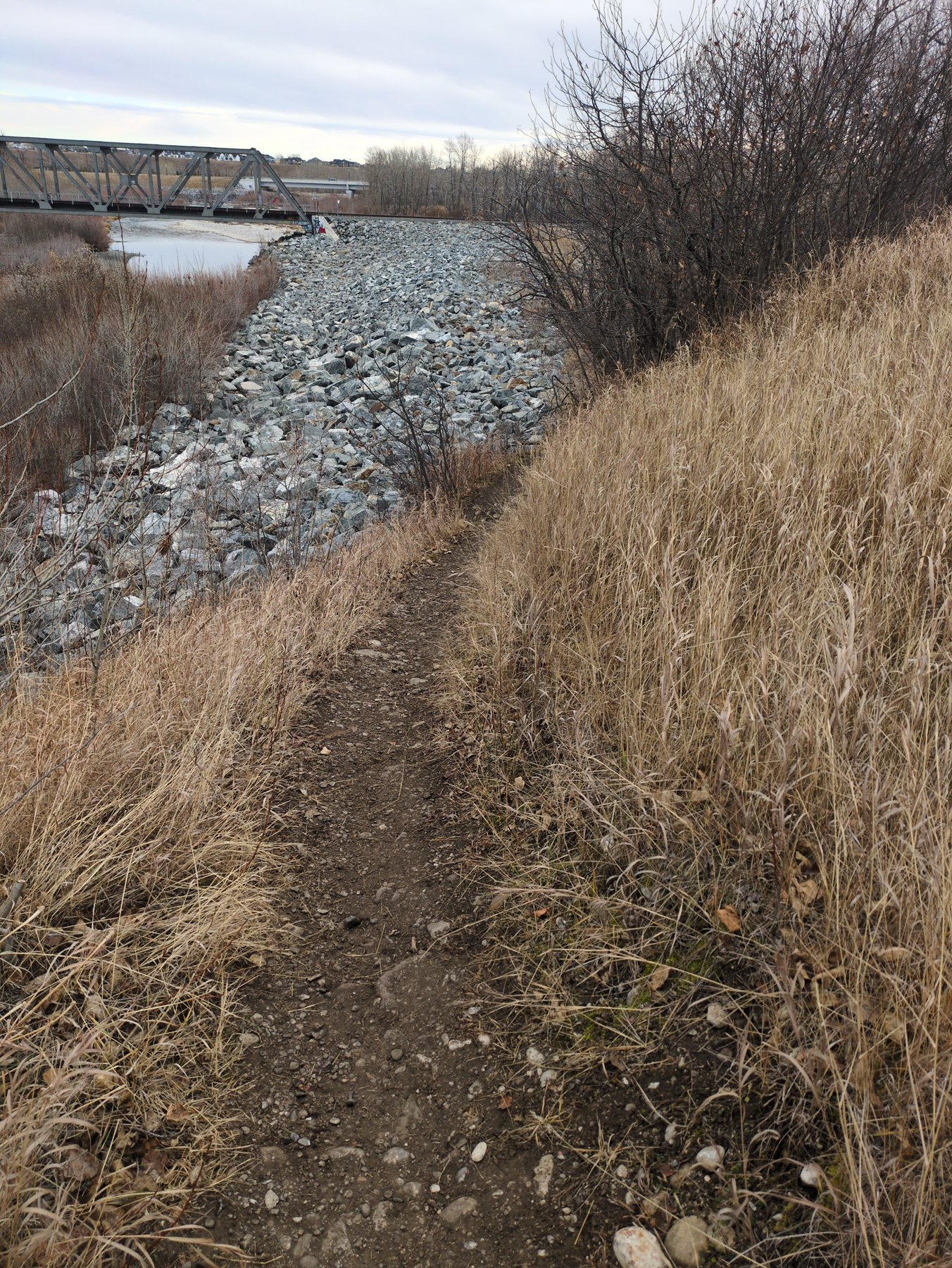
Halfway through, the route got a new stop made on the spot: a bike ride on the
Sheep River pathways in Okotoks. The trail was dirt, moderate, with no obstacles,
signage faded, condition 4/5.
The bank under the bridge is brome-type grass on riprap fill, the kind that spreads along the path.
Rogers held on
1,035 drive readings, median -105 dBm. 142 (14%)
were at the dead-zone line. The weakest road was 306 Avenue E: 21 of 48 readings there dropped out.
Quiet out there
Wildlife was asked for at five stops and wasn't there at any of them. Over the whole
day the tally widget caught one roadkill on Hwy 24, one deer on 48 Street E, and there was one common raven flying over grassland.
Air quality from the Calgary station was AQI 45–53 all day.
Stop by stop every record
Green numbered dots on a photo are what the plant identifier pointed at. Open “What the identifier pointed at” for the key.
1
Hwy 817 → southbound (Wheatland)
Done 09:04 · asked for road surface, wildlife, connectivity
📶 -94 dBm median〰️ road smooth (6.5)drive recorder, 37 readings within 1.5 km
Field briefDrive mode ON here and leave it on all day. Check the widget header says Trip 6 and the HUD shows speed + limit; tap 🪧 whenever a posted sign disagrees with the HUD. Wheatland road — warm-up and the like-for-like Trip 5 comparison.
🐾 wildlifelooked · none seen09:04
2
Bow River at Carseland (Hwy 24 bridge)
Done 09:33 · asked for water, wildlife, scenic
📶 -111 dBm median〰️ road smooth (8)drive recorder, 44 readings within 1.5 km
Field briefThird reading of this site. Park gate was closed on Trip 5 — use a safe pull-off by the bridge. Shore ice yet? Clarity, colour, level vs bank. Photo upstream + downstream. Optional if short on time.
🐾 wildlifelooked · none seen09:33
💧 water body09:32 · ±3 m
Water: RiverClarity: Slightly turbidWaterfowl: NoneShore access: ModerateIce cover: no
River alder (thinleaf / mountain alder)Alnus incana · lowGrasses (dormant bank and verge cover)Poaceae · mediumWillowSalix sp. · lowPoplar / aspen (far bank and floodplain trees)Populus sp. · low
The vegetation framing this shot is a leaning, multi-stemmed riparian shrub-tree growing right at the water's edge of the Bow River, photographed dormant in mid-November.
Full ID notes
The vegetation framing this shot is a leaning, multi-stemmed riparian shrub-tree growing right at the water's edge of the Bow River, photographed dormant in mid-November. Smooth grey bark, slender arching stems and small dark persistent cone-like fruits on last year's twigs point to river alder (Alnus incana ssp. tenuifolia), the usual bank shrub on this stretch of river. A leafless phone photo cannot settle this: willow (Salix sp.) and birch (Betula sp.) overlap heavily in winter silhouette, so treat this as genus-level at best. No plant in the frame is identifiable as an Alberta-listed noxious or prohibited noxious weed, though riparian edges and bridge approaches like this one routinely carry Canada thistle, common tansy and creeping bellflower — none of which can be confirmed here.
What the identifier pointed at (6)
1. Persistent cone-like fruits Small hard dark strobiles still attached to bare twigs in November are the single most alder-like trait; willow and poplar shed their catkins entirely.
2. More strobiles on upper twigs The same blackish pea-sized structures recur along the upper branches, suggesting a real fruiting character rather than insect galls or stuck debris.
3. Smooth pale grey stem The arching trunk is smooth and light grey without peeling papery bark or deep furrows, matching alder rather than mature birch or poplar.
4. Multi-stemmed leaning habit Several slender stems rise from a common base at the bank and lean out over the current, the typical form of a bank-anchored alder or willow clump shaped by ice and high water.
5. Marcescent brown leaves A few dead brown leaves still clinging in mid-November confirm a deciduous broadleaf shrub caught after leaf drop, which is why species-level ID is not defensible from this frame.
6. Tawny bank grass Cured, straw-coloured graminoid cover on the far bank and bridge approach is dormant Poaceae, recordable only at family rank in this condition.
Habitat and how to get a better ID
This is the riparian edge of the Bow River at a highway bridge crossing southeast of Okotoks / Foothills County (50.8304, -113.4199), on the prairie-to-foothills transition. River alder, willow and water birch form the woody fringe along cut banks and gravel bars here, holding the bank against spring runoff and ice scour; the riprap and engineered slope visible on the far bank show the corridor has been reshaped, which favours fast-colonizing bank shrubs. The shrub is growing where it stands rather than being washed up.
Come back in leaf (June–August) and shoot: a close-up of a single leaf showing margin teeth and vein pattern, a close-up of a twig showing whether buds are stalked (alder) or sessile, the bark at eye level with lenticels in focus, and one of the persistent cones at macro distance beside a coin or finger for scale. A shot of the base showing how many stems emerge from the root crown would also help separate a shrub clump from a damaged single tree.
🏞️ scenic09:33 · ±6 m
Feature: RiverAccess: Short walkCrowd: EmptyScenic /10: 6
Willow (shrub willow, riparian)Salix sp. · lowPoplar or aspen (bank gallery tree)Populus sp. · lowDormant prairie and verge grassesPoaceae · mediumUnidentified dry forb stems on the bank benchAsteraceae · low
The plant filling the right half of the frame is a multi-stemmed riparian shrub growing on the cobble bank of a large prairie river, almost certainly a willow (Salix sp.) — slender, flexible, upward-arching stems rising from a clumped base right at the high-water line, with only a scatter of narrow, dried leaves left on 15 November.
Full ID notes
The plant filling the right half of the frame is a multi-stemmed riparian shrub growing on the cobble bank of a large prairie river, almost certainly a willow (Salix sp.) — slender, flexible, upward-arching stems rising from a clumped base right at the high-water line, with only a scatter of narrow, dried leaves left on 15 November. Alberta has well over a dozen native willows (Salix exigua, S. bebbiana, S. lutea, S. amygdaloides and others) that all look like this once the leaves drop, so species is not defensible from a phone photo. Nothing in the frame is confidently a listed noxious species, but river gravel bars in this part of the Bow corridor routinely carry Alberta Weed Control Act plants — Canada thistle, common tansy, absinthe wormwood, and occasionally salt cedar (Tamarix) — so the dry forb stems and grass in the foreground should be rechecked in summer before the site is called clean.
What the identifier pointed at (6)
1. Multi-stemmed clumped base Several slender stems rising together from one root crown at the gravel edge is the classic shrub-willow growth form on a river bar, as opposed to a single-trunked tree.
2. Long whippy twigs Fine, flexible, strongly ascending twigs that taper without heavy side branching are typical of Salix and of flood-scoured riparian shrubs generally.
3. Narrow dried leaves still attached The few leaves left in the upper crown are small and narrow-elliptic, consistent with willow; the sparse mid-November retention matches normal leaf drop for this date in southern Alberta.
4. Cobble bank at water line The shrub is rooted in rounded river cobble right at the active channel margin — the flood-disturbed zone willows colonize first.
5. Pale smooth trunk at right edge A separate, larger stem with grey-green smooth bark at the frame edge indicates a poplar or aspen in the bank gallery behind the willow thicket.
6. Cured tan bunchgrass Dormant, straw-coloured grass and dry forb stems along the trail bench are the upland prairie/verge component above the riparian shrub line; identifiable only to family at this stage.
Habitat and how to get a better ID
The coordinates place this on the Bow River at the Highway 24 crossing near Carseland, Foothills/Wheatland country east of Okotoks — a wide, cobble-bedded prairie river cutting through grassland benches. Shrub willows occupy exactly this band: the scoured cobble and sand between summer low water and the spring flood line, where ice shove and current kill off anything less flexible. Behind them the bank rises into balsam poplar gallery woodland and then cured mixed-grass prairie, and the bridge approach fill adds a disturbed verge strip that typically collects weedy species.
Come back in June or July and photograph one stem close up: upper and lower leaf surface (showing margin teeth and whether the underside is whitish), a twig showing bud arrangement and whether the bud has a single cap-like scale (diagnostic for Salix), and any catkins. A shot of the base showing bark texture and the overall clump, plus a wide frame showing how far up the bank the thicket runs, would let this go from genus to species.
📶 -108 dBm median〰️ road smooth (7)drive recorder, 22 readings within 1.5 km
Field briefProvincial highway (Alberta Transportation maintains it, not the county) — but it's the county's east-west spine. Dead zone expected ~20 km west of Hwy 24: matters to a crew with no radio/cell there. Note shoulder width, edge drop-offs and rumble strips. Any pothole, edge break, washout, or missing/damaged sign: log Road damage with a photo (parked only).
📶 -102 dBm median〰️ road smooth (8)drive recorder, 21 readings within 1.5 km
Field brief7 km of county gravel — what most of the county's ~1,400 km of gravel looks like. Watch for: washboard, loose windrows/berms of gravel, soft spots, crown and ditch water, culvert ends, recent grader passes, oiled dust-control strips in front of houses (county pays the first 100 m for homes within 300 m), and any road-ban signs. Ground truth = surface state (dry/wet/snow/ice) at the stop. Any pothole, edge break, washout, or missing/damaged sign: log Road damage with a photo (parked only).
🐾 wildlifelooked · none seen10:06
7
338 Ave E at the Hwy 2 crossing
Done 12:58 · asked for road surface, road damage, general
📶 -102 dBm median〰️ road smooth (7)drive recorder, 27 readings within 1.5 km
Field brief338 Ave E is the county road along Okotoks' north edge, Hwy 2A out to Hwy 2 — roughness from the mount. Where it meets Hwy 2 is the at-grade crossing the province, town and county studied for an interchange (study done 2023, no build date) and the median-closure work. From the 338 Ave side only — never stop on Hwy 2: how long a gap you wait for, queueing, warning signs, any closure notices. Any pothole, edge break, washout, or missing/damaged sign: log Road damage with a photo (parked only).
🚧 road damagelooked · none seen12:58
📝 generallooked · none seen12:58
+
Along the way
Ad-hoc records and widget notes
🐦 birds09:53 · ±0 m
“Raven”
Group: OtherSpecies: Common RavenDoing: FlyingHabitat: Grassland
📝 general13:11 · ±7 m
“There was a 65 speed limit at the top of this hill”
Trail ride Sheep River pathways, Okotoks
Added from the road with the app's new ➕ Add stop: a 🚲 Trail ride preset asks for trail, wildlife, birds, plants and views,
and starts the bike recorder.
This is a late-season (mid-November) grass-dominated verge flanking a riprap-armoured river bank, with the pale straw-coloured sward on the right being the most prominent vegetation in the frame.
Full ID notes
This is a late-season (mid-November) grass-dominated verge flanking a riprap-armoured river bank, with the pale straw-coloured sward on the right being the most prominent vegetation in the frame. The bulk, height and dense sod habit of that grass fit the introduced agronomic grasses that blanket disturbed banks along the Sheep/Highwood River corridor near Okotoks — most likely smooth brome (Bromus inermis), with quack grass (Elymus repens) and Kentucky bluegrass also plausible — but cured winter culms with the inflorescences mostly shattered cannot be taken past family rank honestly. Smooth brome and quack grass are both aggressive non-natives on Alberta's invasive-species radar (quack grass is a nuisance weed under the Alberta Weed Control Act), so if the ID firms up this patch is an introduced, bank-colonizing stand rather than native fescue prairie.
What the identifier pointed at (6)
1. Dense cured sward A continuous, uniform straw-coloured grass sod blanketing the slope — sod-forming introduced grass rather than a bunchgrass mosaic.
2. Persistent fine panicles Thin nodding seed-head remnants still held above the sward in November; shattered, so florets cannot be counted.
3. Leafless shrub thicket Multi-stemmed, fine, reddish-brown twiggy shrubs along the bank break — the willow/dogwood/buffaloberry guild typical of Foothills riparian edges; no leaves or catkins to narrow it.
4. Riprap armour Quarried angular rock bank protection; the raw fill surface is what the aggressive introduced grasses and shrubs colonize first.
5. Bare trampled footpath Compacted gravelly trail cutting the sward — the disturbance corridor that spreads brome and quack grass seed along the bank.
6. Background poplar/aspen stand Grey leafless broadleaf trees with upright branching across the river — the Populus riparian gallery of the Sheep River valley.
Habitat and how to get a better ID
Taken at 50.7129, -113.9532 — the Sheep River corridor at Okotoks, Alberta, on a riprap-armoured bank below a truss bridge with new residential development behind. This is a classic aspen-parkland/foothills riparian edge: disturbed engineered fill colonized by tall introduced grasses, a willow-and-shrub thicket at the water's edge, and balsam poplar/aspen on the floodplain beyond. Mid-November means everything is fully cured and dormant; nothing here is in flower.
Confidence is low because the grass is cured and shattered. A close, in-focus shot of one culm showing an intact panicle or spike, the leaf blade width and the collar/ligule region would separate smooth brome from quack grass or bluegrass; a second close-up of a shrub twig showing bud arrangement (alternate vs opposite) and bark colour would let the willows and dogwoods be split; and a shot of the base of a clump showing whether it is rhizomatous turf or a discrete bunch would be decisive.
Road by road roughness + signal
Every drive reading snapped to the nearest OpenStreetMap road, in driving order. Roughness is the dash-mount score: under 15 smooth,
15–35 fair, 35+ rough. Surface is what the map says, where it says anything.
Road
Map surface
km logged
Roughness (median)
Signal
Dead
Hwy 1
asphalt
4.7
6 · max 11
-97 dBm
1
Hwy 817
asphalt
42.4
8 · max 26
-102 dBm
16
Hwy 24
—
22.6
8 · max 22
-108 dBm
25
Hwy 547
asphalt
34.4
8 · max 20
-108 dBm
38
Hwy 7
asphalt
1.0
7 · max 14
-99 dBm
Hwy 2A
—
3.9
7 · max 10
-96 dBm
1
32 Street E
asphalt
1.2
8 · max 10
-88 dBm
Southbank Boulevard
asphalt
0.2
7.5 · max 13
-99 dBm
370 Avenue E
asphalt
0.7
7 · max 10
-93 dBm
48 Street E
asphalt
3.0
5 · max 8
-106 dBm
2
338 Avenue E
paved
2.9
7 · max 11
-103 dBm
4
80 Street E
paved
6.3
8 · max 21
-98 dBm
7
Hwy 552
—
19.7
7 · max 16
-103 dBm
12
306 Avenue E
—
7.9
8 · max 16
-112 dBm
21
Township Road 212
—
6.4
8 · max 23
-110 dBm
10
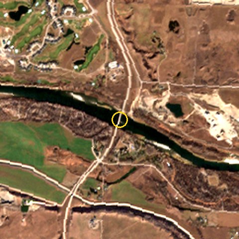
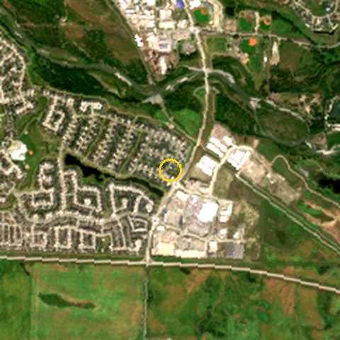
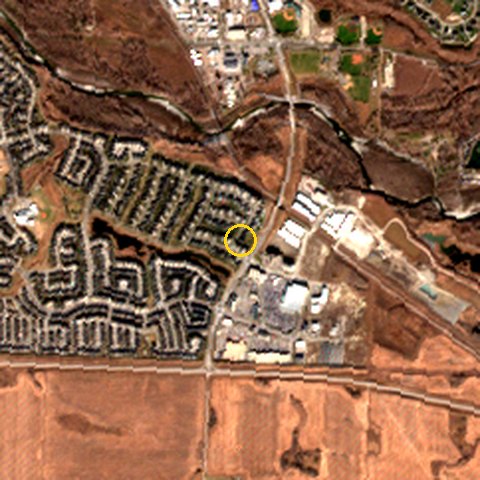
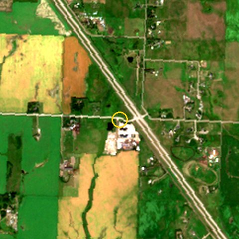
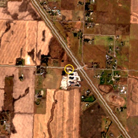
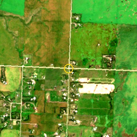
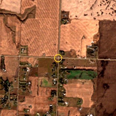
From orbit Sentinel-2
The clearest Sentinel-2 pass in mid-summer and in the weeks before the trip, 2.4 km square, 10 m true colour, site ringed in yellow.
Same spot, two seasons.
Bow River at Carseland
Mid-summer: 2026-08-15 · 100% clear · open water 34.3 ha
Trip week: 2026-11-08 · 100% clear · open water 24.2 ha
Sheep River pathways, Okotoks (trail ride)
Mid-summer: 2026-08-15 · 100% clear · open water 11.0 ha
Trip week: 2026-11-08 · 100% clear · open water 5.8 ha
338 Ave E at the Hwy 2 crossing
Mid-summer: 2026-08-15 · 100% clear
Trip week: 2026-11-08 · 100% clear
128 Street E at Hwy 547 (stop 4)
Mid-summer: 2026-08-15 · 100% clear
Trip week: 2026-11-08 · 100% clear
What went wrong, and what's left out
The route changed on the road. Around 12:30 the rest of the plan was cut by voice: 5. 306 Ave E & 32 St E, 6. Dunbow Road roundabout, 8. Sheep River, downtown Okotoks, 9. Highwood River at Hwy 547 bridge, 10. Hwy 547 → eastbound, pass 2 were dropped,
and the way home became Hwy 552 east. The drive then stayed on 552 to its end and carried on along the 306 Ave E / Township Road 212 gravel to Hwy 24.
Four wildlife records were forced. The stop form wouldn't submit without wildlife details, so at stops 1–4 the collector filled in what
wasn't there. All four were corrected to “looked, none seen” the same day, along with one made-up activity at the Bow, and the form was fixed
(Ground Boots v1.64–v1.65). Their notes and the two voice memos about it are left out here.
128 Street E wasn't driven. Stop 4 was logged at the Hwy 547 junction, so there's no gravel reading for 128 St itself.
The ride track is patchy. The bike recorder ran in pieces (43 fixes over 117 min) and missed most of 10:53–11:54, so the
ride map shows where the ride went, not every turn. Distance between fixes is about 3.0 km.
Masked for privacy: 0 readings within 3 km of a private address aren't drawn. They still count in the totals.